Adding Hard Lines, Lease Lines, and Corridors to a Job in Drakewell
Introduction
A critical component of accurate wellbore placement is that, in addition to being to be in zone, the well needs to be drilled within certain boundaries like hard lines, lease lines, or other types of corridors. A popular request from our users has been the ability to add polylines to a job in Drakewell giving field personnel visibility to where they’re at in relation to these boundaries at any given time. The late February 2019 deployment added our first version of this feature set to Drakewell.
Here’s how version one works.
How it works
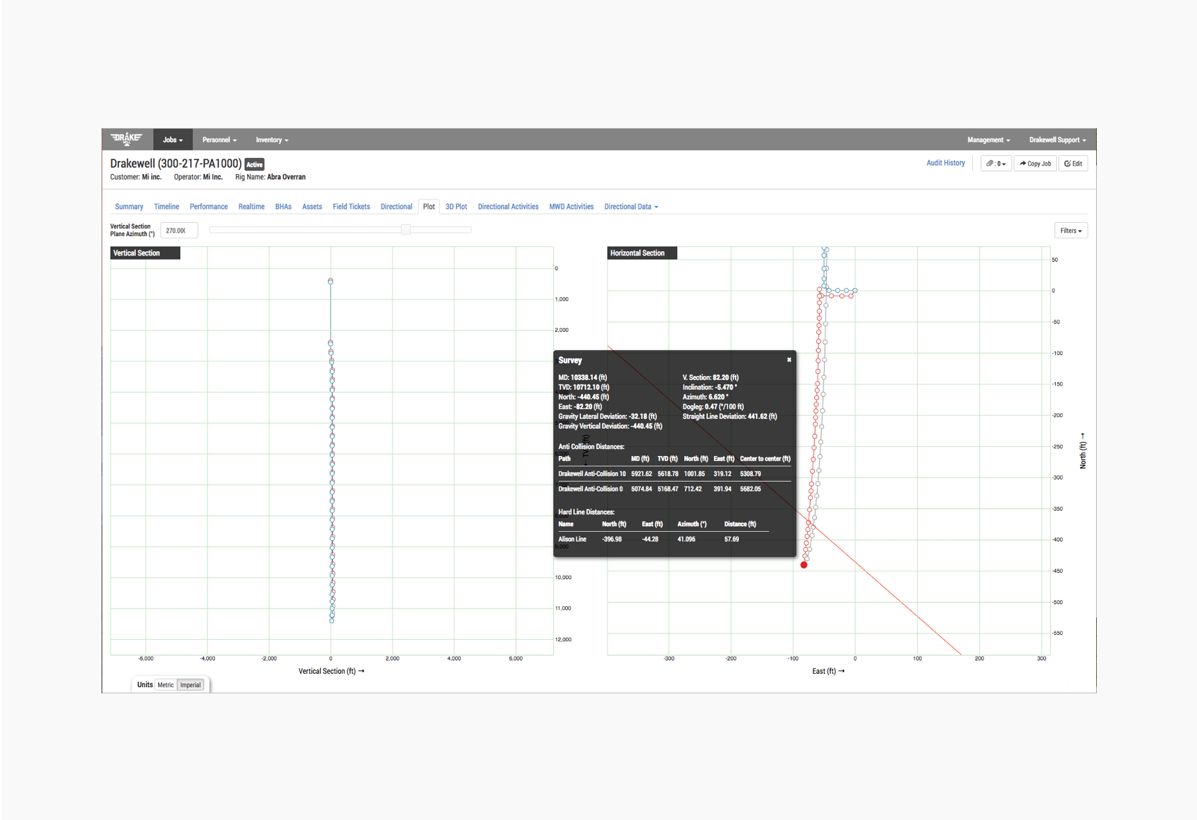
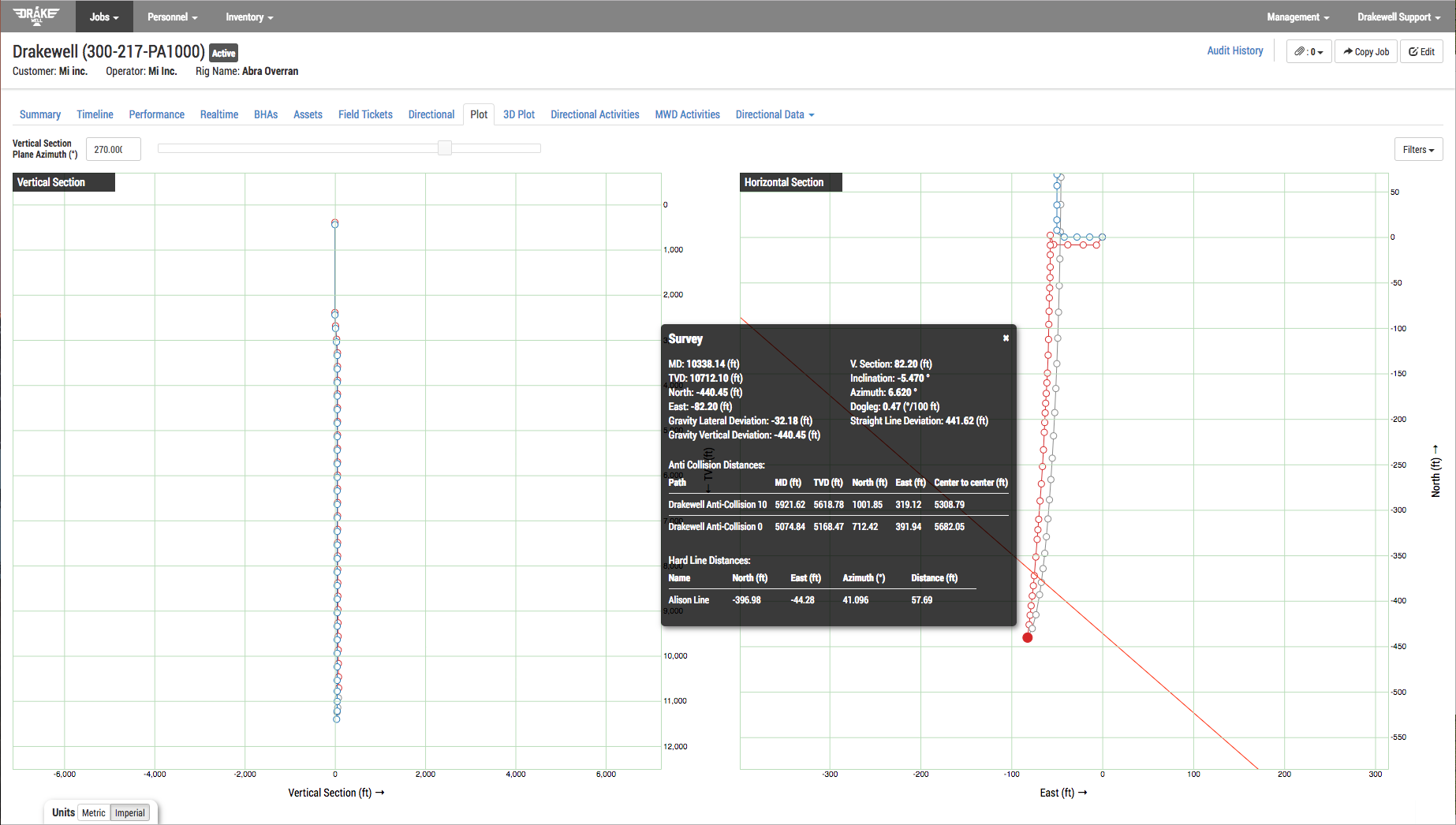
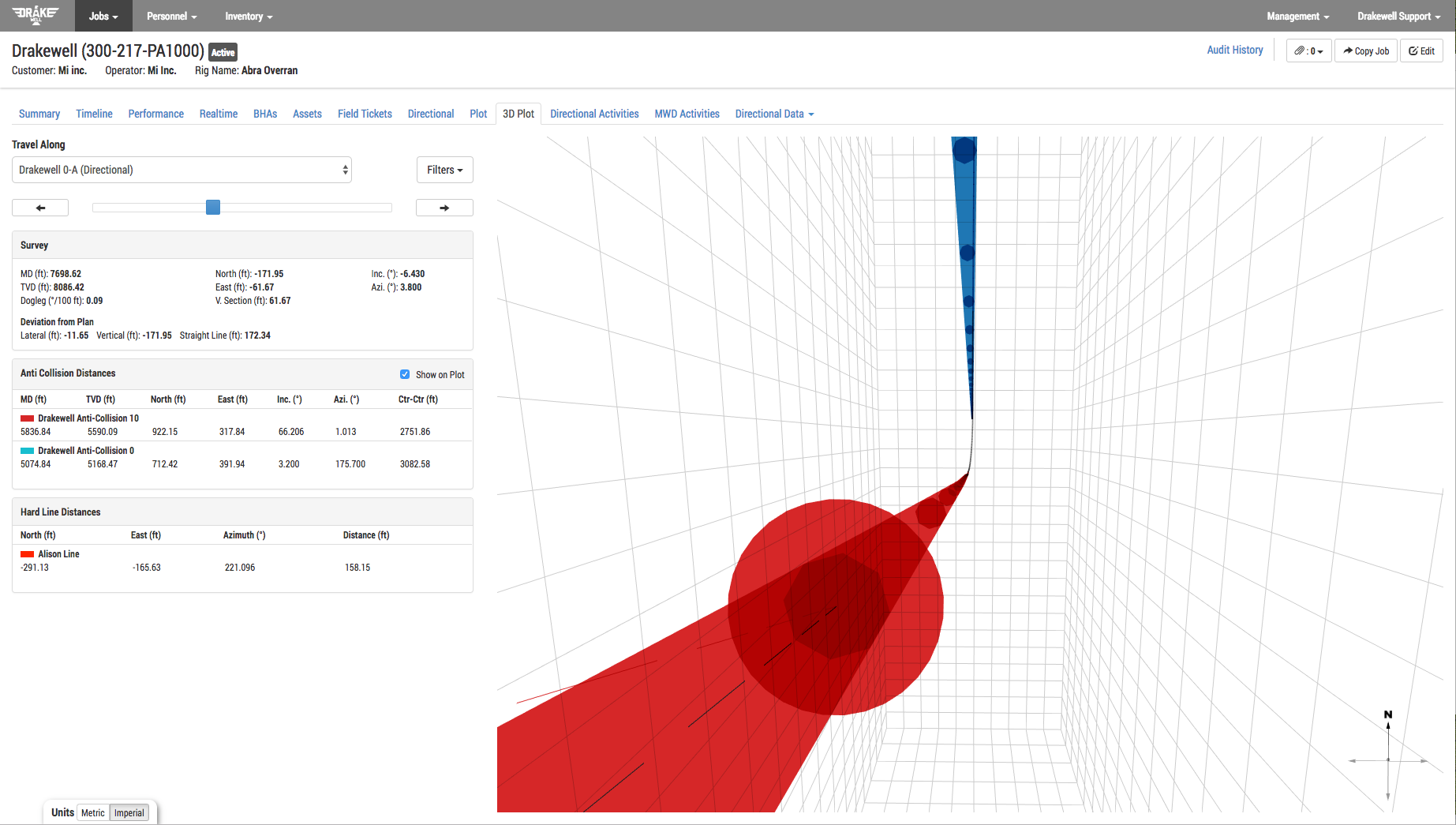
After adding a set of polylines, anyone with access to the job will be able to see the distances from the as-drilled wellbore, well plans or projected paths to those lines.
These distances show on the 2D plot along with a rendering of the lines and the distances are also shown on the 3D plot under the anti-collision distances.

Polylines on 2D Plot Polylines on 3D Plot
How to Use It
The key to using the new polyline feature is adding the polylines to a job. Well Plans and Well Paths have been reorganized in the interface to group them together under the Well Plan Data tab. In addition, Polyline is a selection in the grouping where you can add polylines to the job.
Each group of polylines can be added to the job by either uploading a file or pasting polyline data into the available text box.
Note: The file upload simply uploads the polyline data into the available text box.
The polyline data is a tab delimited format which is the default format that comes from Compass in their polyline editor. This feature is not limited to Compass and as long the text is in a format readable by Drakewell it will import and properly place the polylines.
Each polyline added to the job will create a grouped polygon which can be named and have a color assigned.
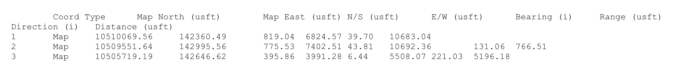
Note: The coordinates of the polygon will need to be relative coordinates to the the well. In this version of polylines only the following fields are used from the above file: Map North (usft), Map East (usft), N/S (usft), E/W (usft).
What’s Next
Our next steps with this feature set will be to add a at least one additional file and text format to simplify importing polylines.
We’re also exploring ways to display them in 3D on the 3D plot, though we’re taking caution to not clutter the visuals of that valuable screen.
And, as always, “what’s next” is driven by the needs and requests of our users. We’re looking forward to feedback as you begin to use this new feature set. You can find our contact information here help.drakewell.us